
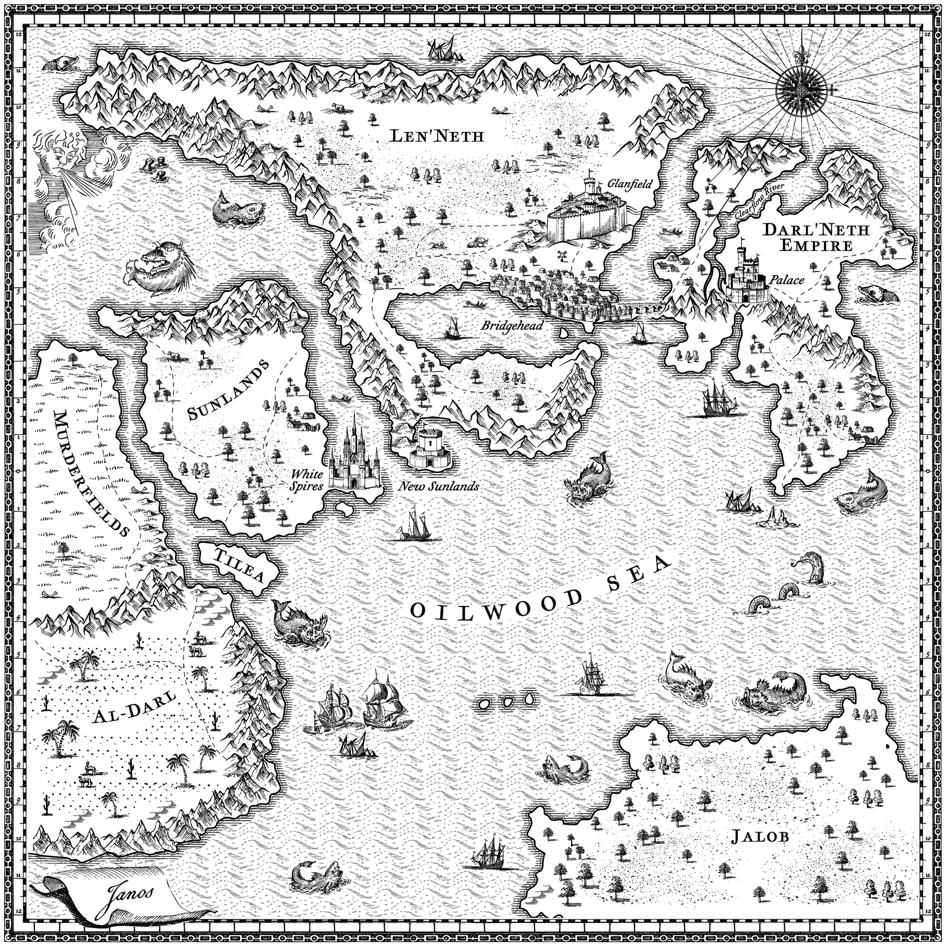
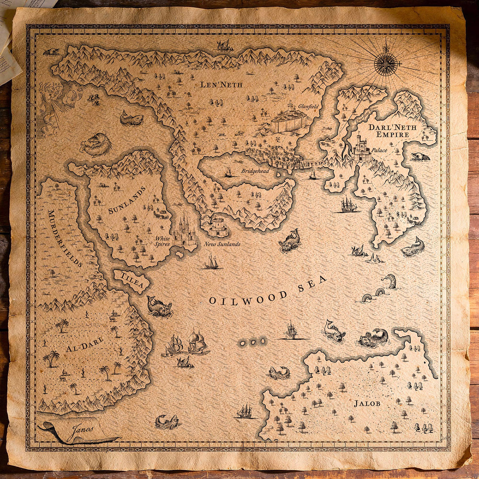
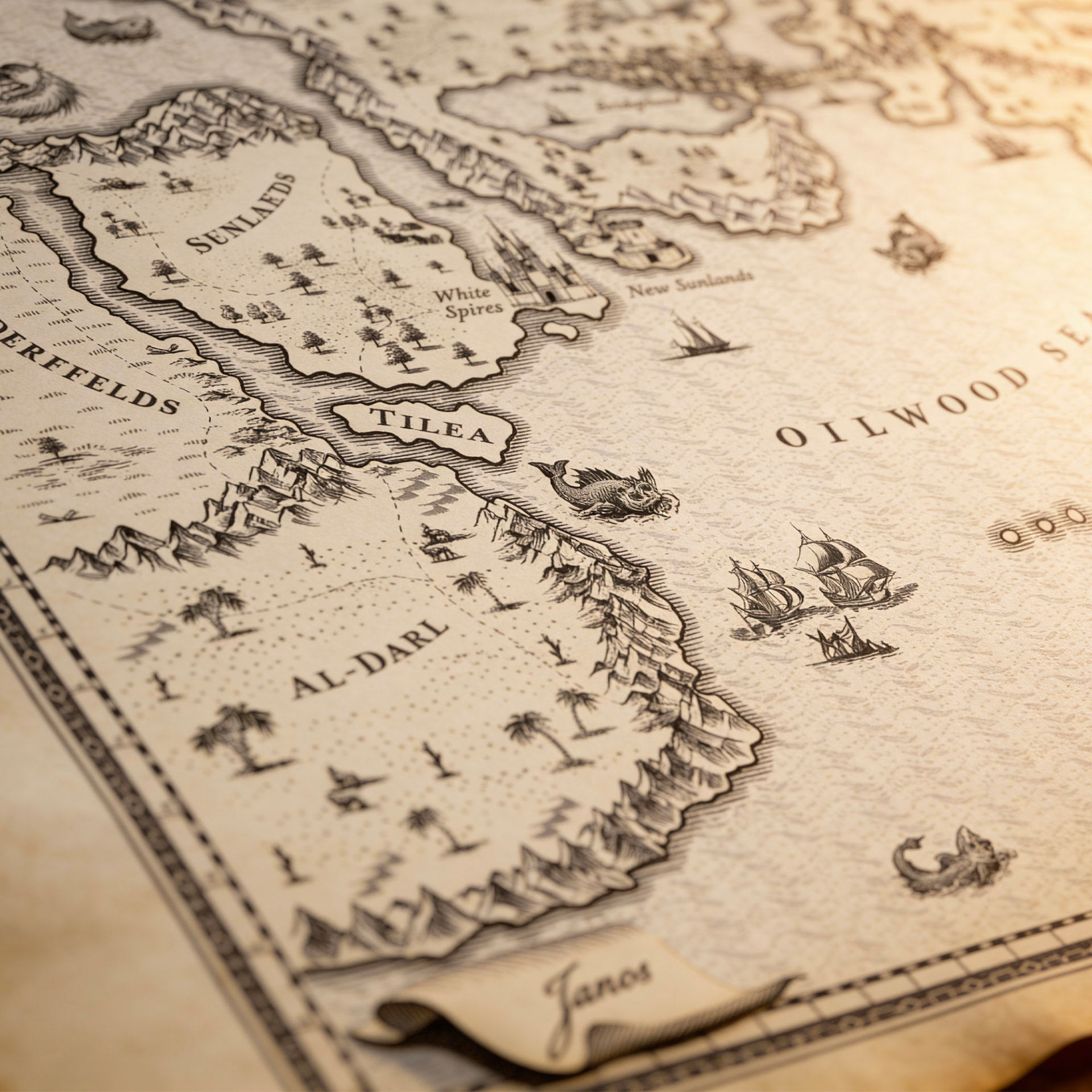
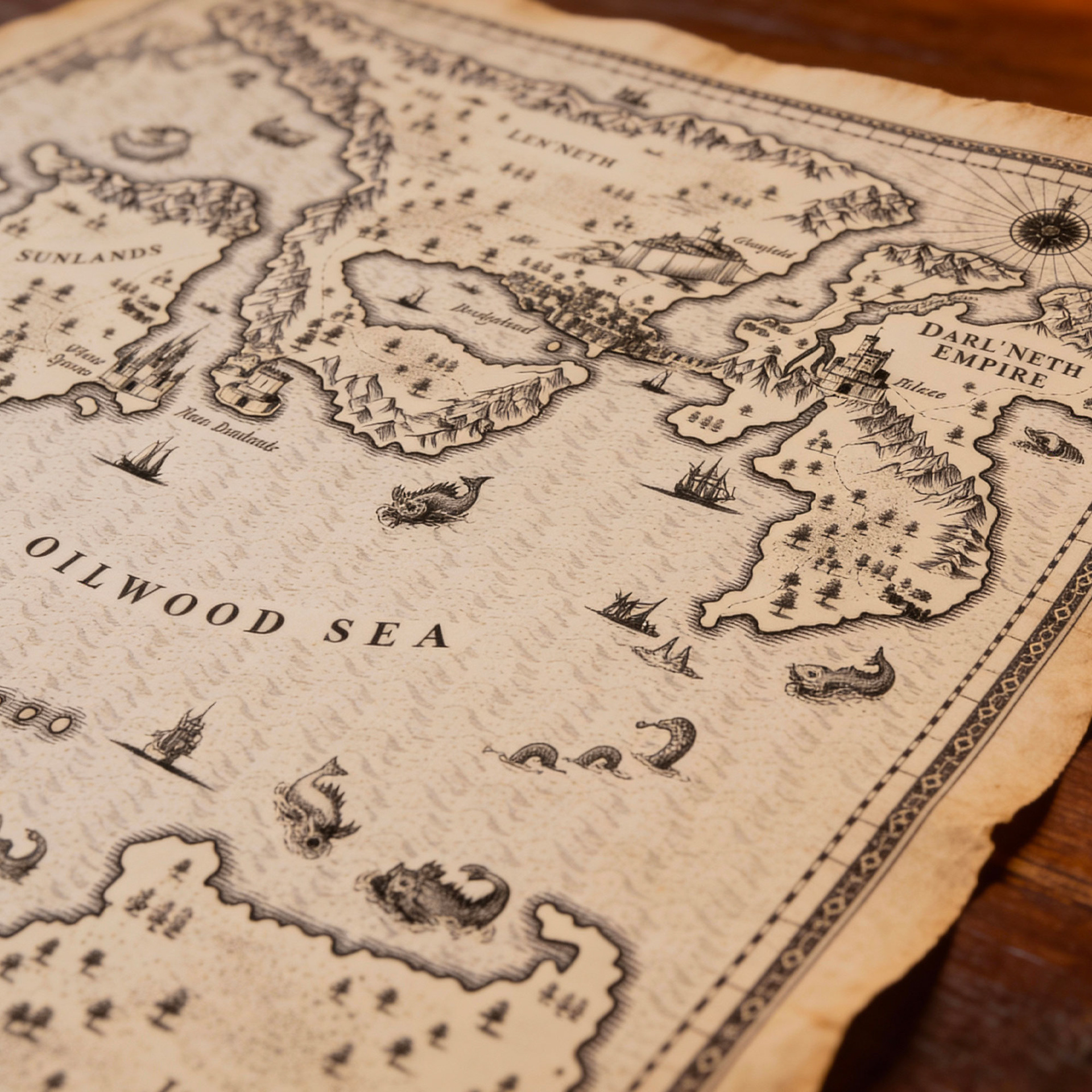
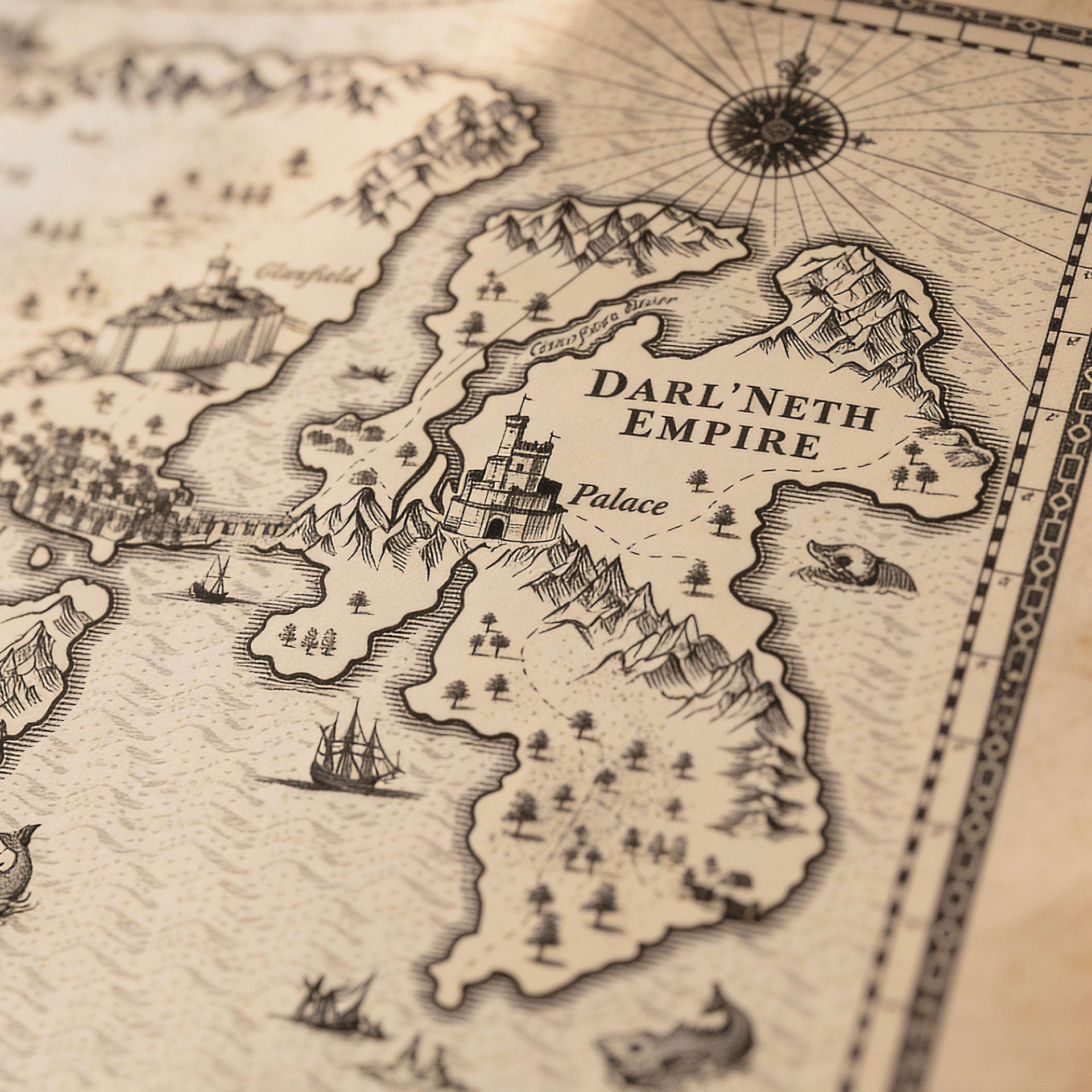
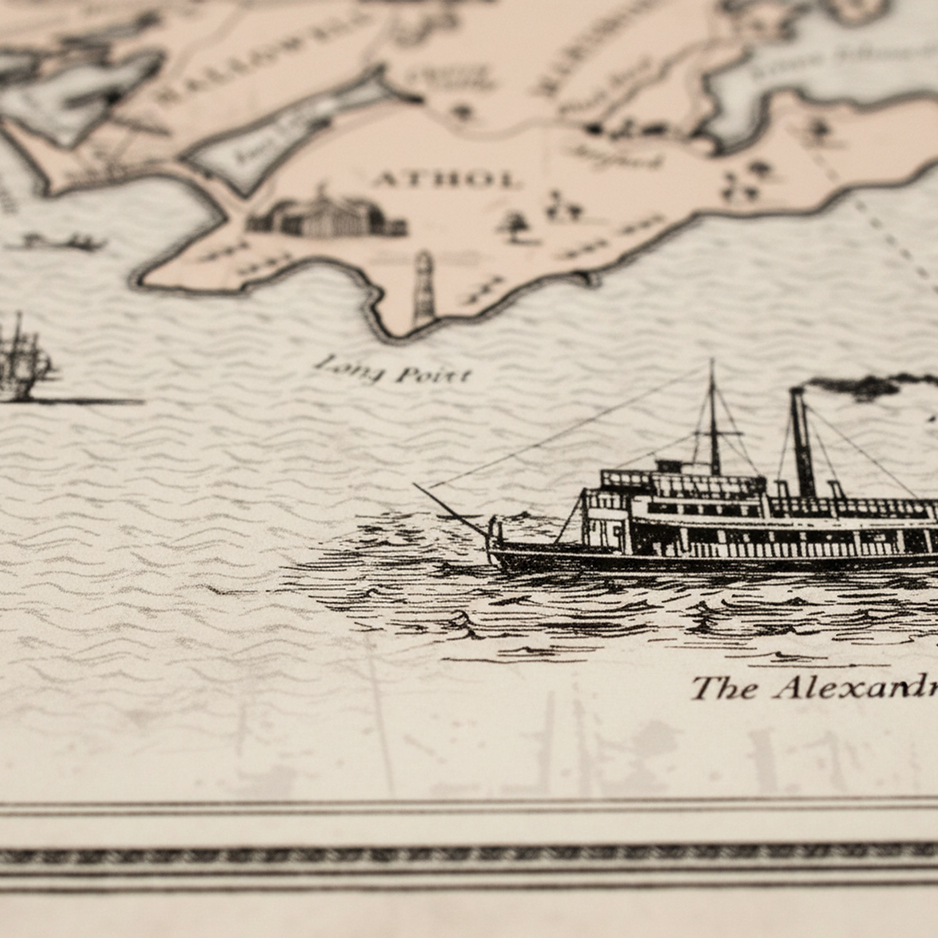
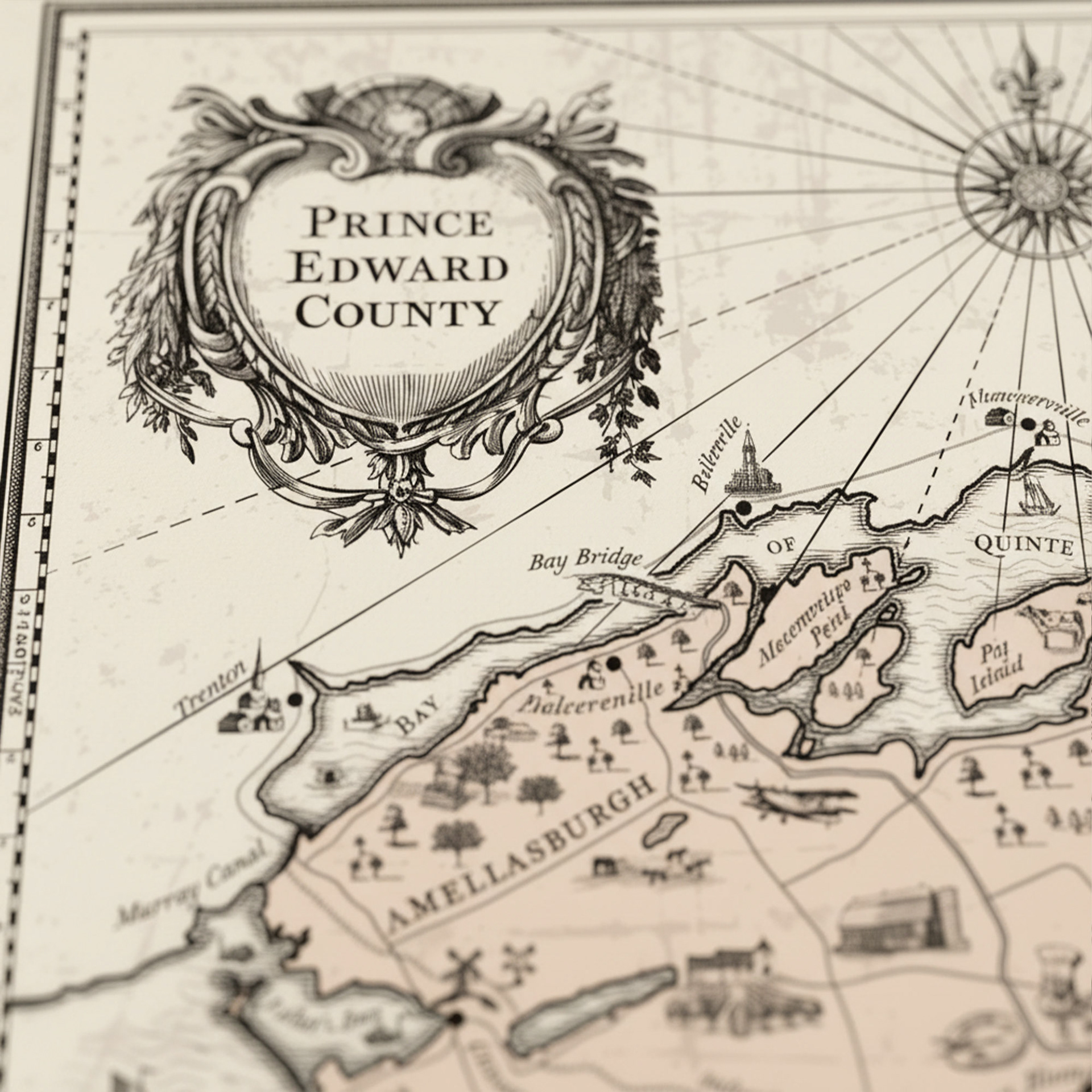
A hand-drawn fantasy map inspired by medieval cartography and classic nautical charts. It features detailed coastlines, mountain ranges, fortified cities, and mythic sea creatures. An ornate border and compass rose frame the composition, reinforcing its identity as a complete historical artifact. Decorative elements such as sea monsters, sailing ships, and an ornate compass rose reinforce the mythic tone while grounding the design in historical mapmaking traditions. See also Prince Edward County Ontario custom map.
Prince Edward County Ontario tourist map.
This map of Prince Edward County, Ontario, Canada, is a vintage-style illustrated map that blends cartographic accuracy with artistic embellishment. The entire map is rendered in a historical style reminiscent of 17th–18th century cartography. It's designed to evoke a sense of place, history, and heritage—ideal for tourism materials, heritage branding, or decorative use.
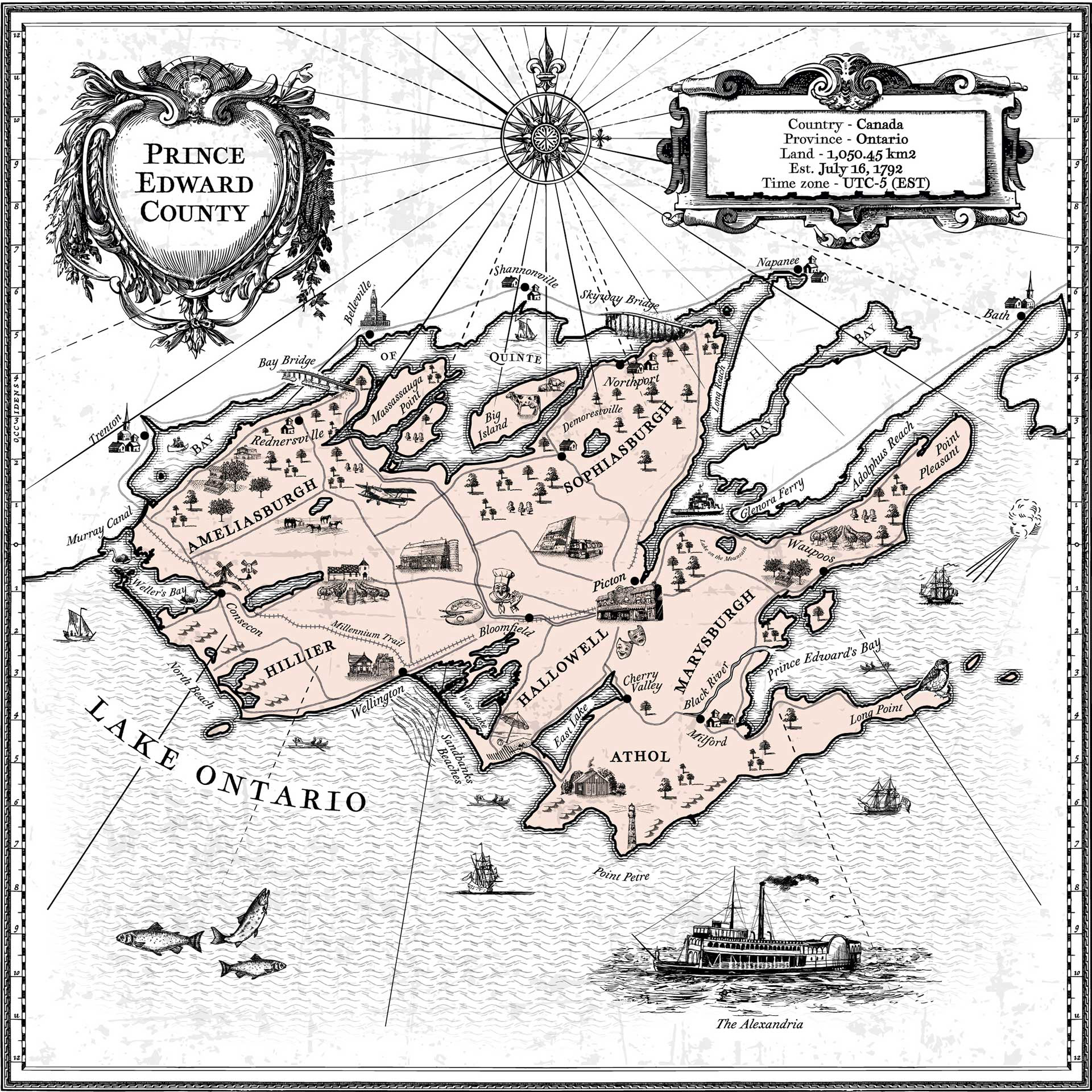
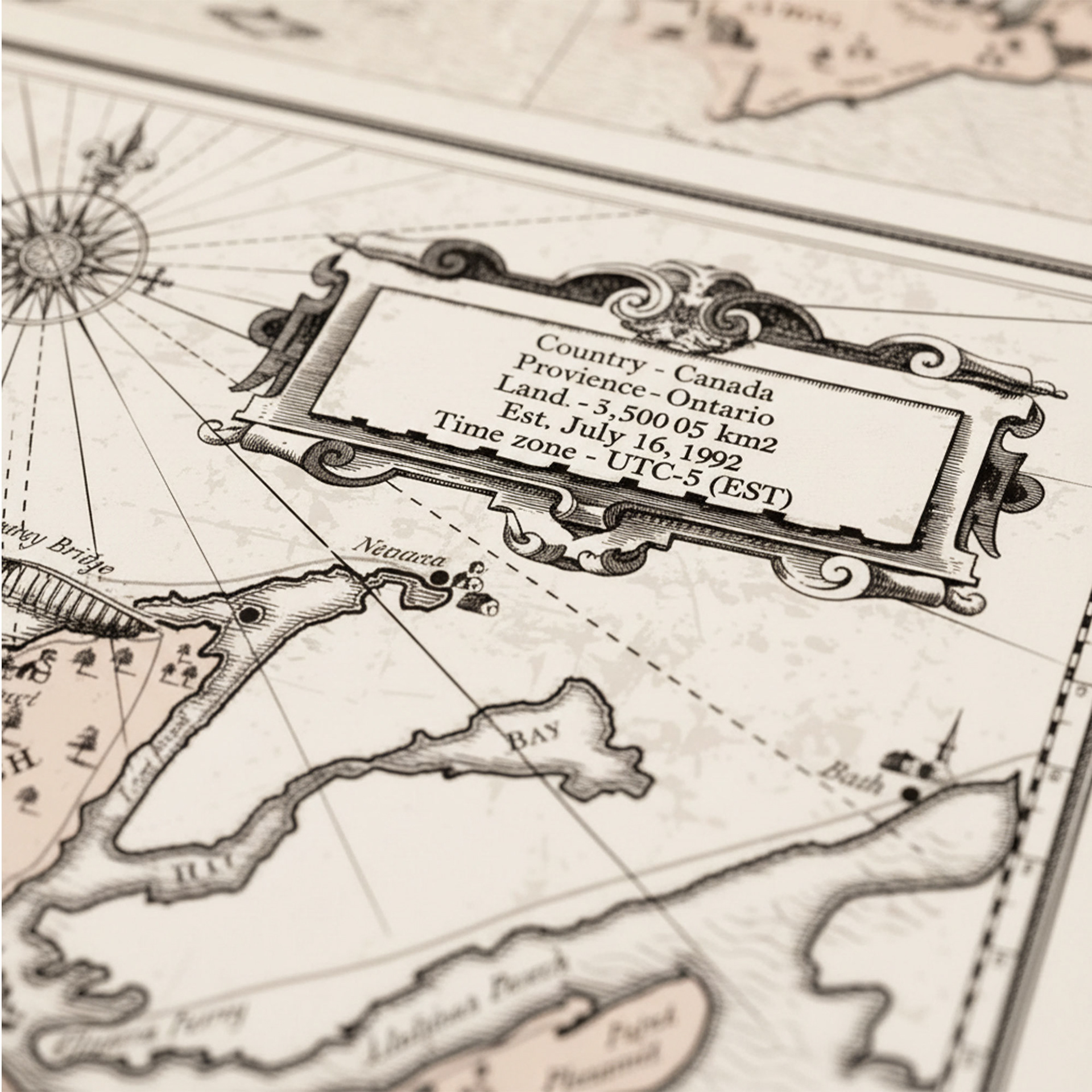
The blend of practical cartography and romanticized illustration makes it visually engaging and richly atmospheric
_____________________________________________________________________
If you like our works, we’d be happy to collaborate and create premium design for your product. Feel free to reach out: team@premiumlabel.design / whatsapp: +420 776 246 535 or by using contact form below.
Thank you!