
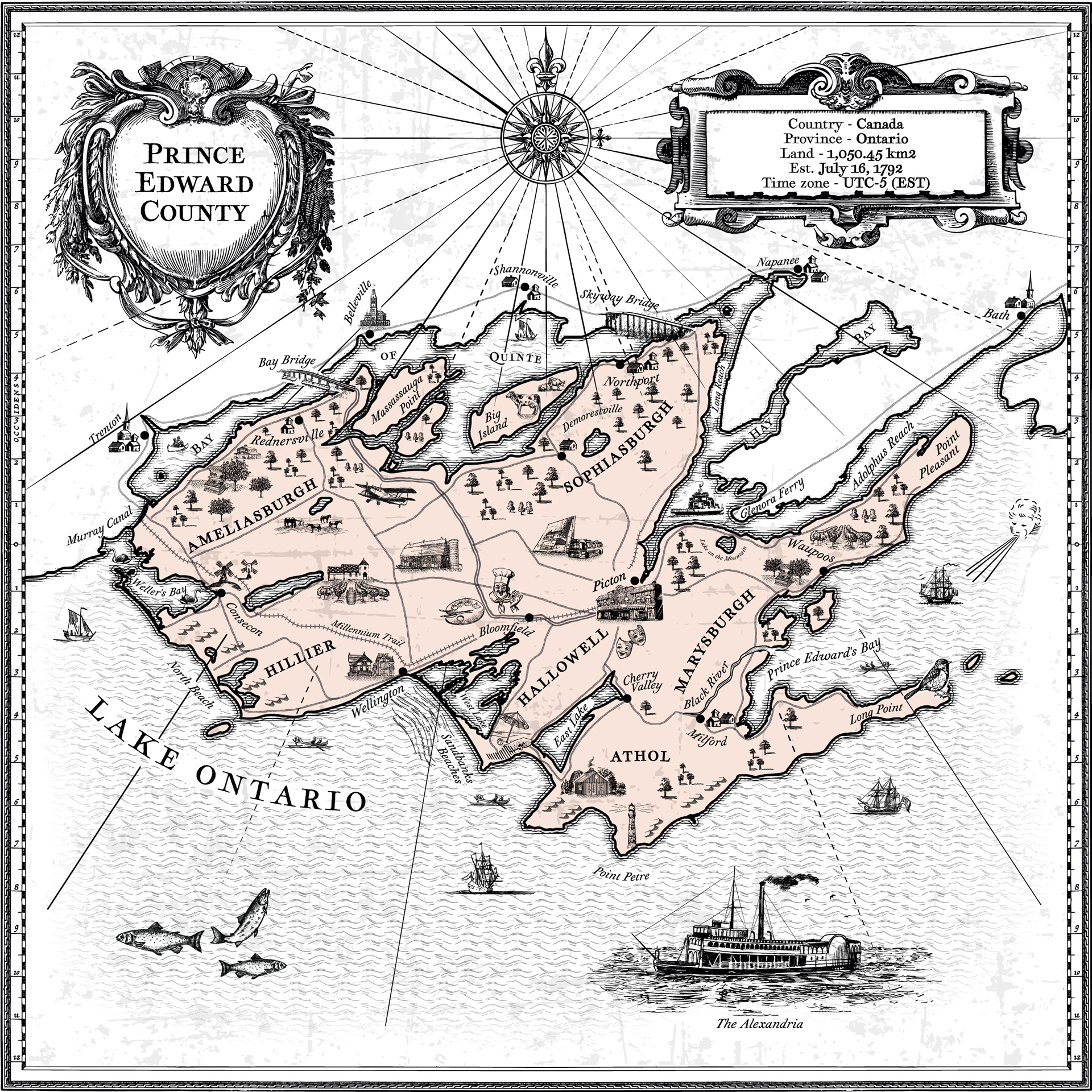
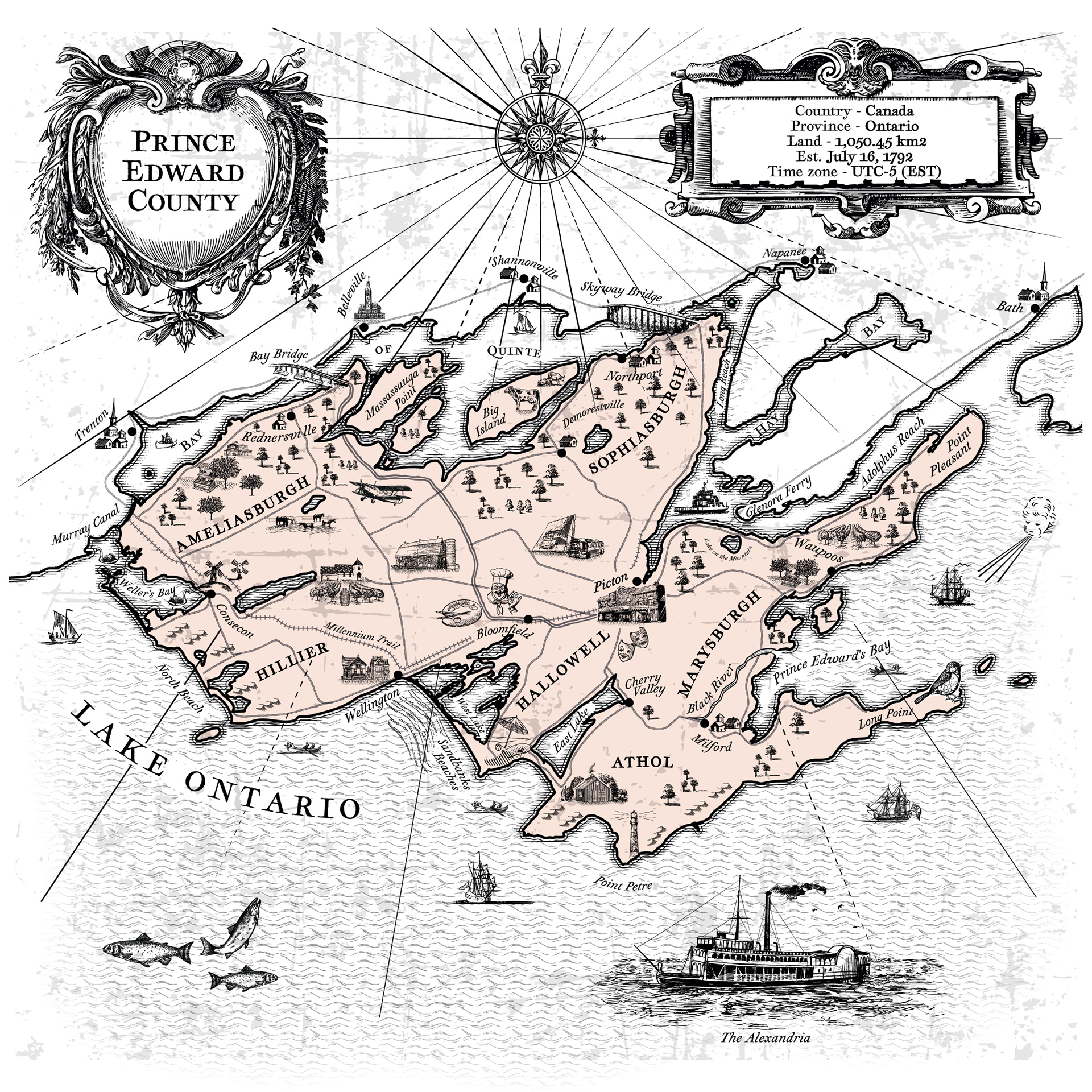
This map of Prince Edward County, Ontario, Canada, is a vintage-style illustrated map that blends cartographic accuracy with artistic embellishment. The entire map is rendered in a historical style reminiscent of 17th–18th century cartography. It's designed to evoke a sense of place, history, and heritage—ideal for tourism materials, heritage branding, or decorative use. The blend of practical cartography and romanticized illustration makes it visually engaging and richly atmospheric. See also Fantasy Map inspired by medieval cartography.
Feel free to drop us a line.
Thank you!